Quick Facts
- Total Annual Visitors: Over 3,000,000 people explore this 800,000-acre wilderness where the Mojave and Sonoran deserts collide.
- Top Easy Trails: For a quick introduction, head to the Cholla Cactus Garden Loop (0.25 miles), Keys View (0.1 miles), or the Discovery Trail (0.7 miles).
- The Oasis Experience: The 3-mile round-trip Fortynine Palms Oasis Trail is the premier destination for seeing towering fan palms and natural spring-fed pools.
- Critical Safety: Every hiker must carry at least one gallon of water per person, per day. Dehydration is the park's most silent and effective predator.
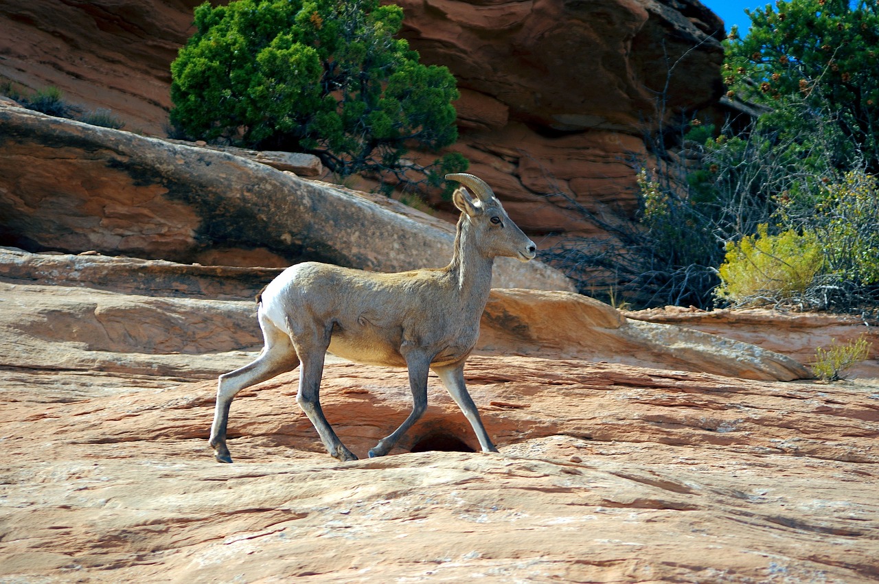
- Wildlife Sightings: Joshua Tree is home to approximately 200 desert bighorn sheep, often seen near high-altitude peaks or rare water sources like Barker Dam.
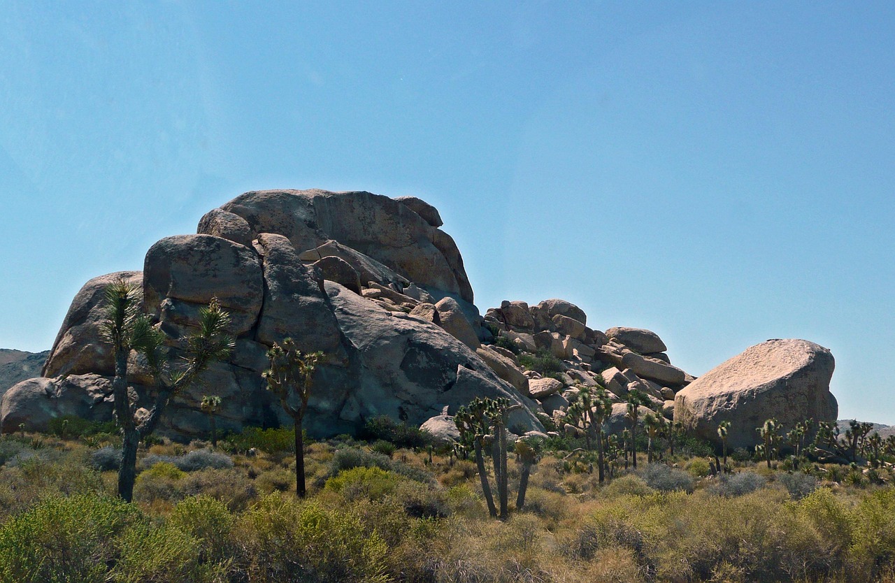
I’ve stood on the summits of the Andes and trekked through the densest jungles of Southeast Asia, but there is something about Joshua Tree National Park that humbles me every single time. It’s a landscape that feels like it belongs on another planet—a surrealist painting brought to life with honey-colored boulders, creaky, twisted trees, and a silence so profound you can hear your own heartbeat.
This park is a tale of two deserts: the high Mojave, characterized by its iconic Yucca brevifolia (Joshua trees) and cooler altitudes, and the lower Sonoran, defined by its creosote bush and branching ocotillo. Between these two ecosystems lies a history rich with the echoes of the Pinto culture, 19th-century cowboys, and gold-fevered miners. Whether you're here to scramble over monzogranite boulders or seek out a secret desert spring, these trails offer a raw, unfiltered connection to the American West.
Essential Joshua Tree Safety: The Golden Rule of Water
Before we lace up, we need to talk about survival. The desert is beautiful, but it is indifferent to your presence. I always tell people the story of Paul Miller, a seasoned hiker who went missing on a short trail in 2018. His story serves as a somber reminder: in Joshua Tree, staying on the marked trail and being over-prepared isn't just a suggestion—it's life or death.
The air here is so dry that your sweat evaporates before you even feel it. You are losing moisture with every breath. To prevent dehydration, heatstroke, and exhaustion, experts (and yours truly) recommend carrying at least one gallon of water per person, per day. If your water bottle is half empty, your hike is over. Turn back.
Pro-Tip: Cell service in the park is non-existent. Download your offline maps (AllTrails or Gaia GPS) before you pass the park gates. Do not rely on your phone’s live connection once you're deep in the boulders.
10 Summer Hiking Essentials Checklist:
- Water: 1 gallon per person (minimum).
- Electrolytes: Salt tablets or powders to replenish what you sweat out.
- Sun Protection: SPF 50+, wide-brimmed hat, and polarized sunglasses.
- Footwear: Sturdy hiking boots with aggressive grip for rock scrambling.
- Navigation: Physical map and compass (or downloaded offline maps).
- First Aid: Including tweezers (for cactus spines) and a whistle.
- Extra Layers: Temperature can drop 30 degrees the moment the sun sets.
- High-Calorie Snacks: Trail mix, jerky, and energy bars.
- Headlamp: With extra batteries, just in case a sunset hike takes longer than planned.
- Emergency Blanket: Compact and vital if you’re forced to spend an unplanned night out.

Section 1: Beginner-Friendly Loops & Iconic Views
If it’s your first time in the park, or if you’re traveling with family, you don’t need to suffer a 10-mile slog to see the best of Joshua Tree. Some of the most profound geological features are located just steps from the asphalt.
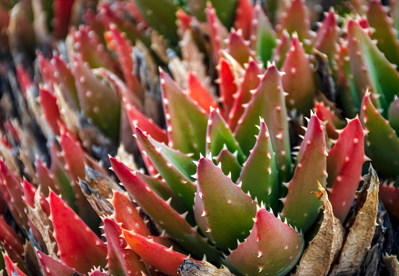
The Cholla Cactus Garden Loop is a 0.25-mile walk that I recommend doing exactly at sunrise. As the light hits the "Teddy Bear" Cholla, their silver-white needles glow with an ethereal light. Just don't let the name fool you—if you touch one, the barbed spines will hitch a ride in your skin, and they are notoriously painful to remove.
For the ultimate perspective of the region’s geology, head to Keys View. While it's only a 0.1-mile paved loop, it offers a staggering panoramic view of the San Andreas Fault, the Salton Sea, and on clear days, even Mount Signal in Mexico. It’s a humbling reminder of the tectonic forces that shaped this landscape over millions of years.
If you want a "sampling platter" of the park's geology, the Discovery Trail (0.7 miles) is your best bet. Designed by local high school students, this trail connects to the Skull Rock area and winds through massive boulders, offering plenty of opportunities for light scrambling without the risk of getting lost.
Section 2: Historic Gold Mines & Cowboy Hideouts
Beyond the natural beauty, Joshua Tree is a graveyard of dreams. During the late 1800s, miners swarmed these hills hoping to strike it rich.
The Desert Queen Mine Trail takes you back to the park’s most productive gold-mining era (1895–1961). It’s a moderate hike that leads to the remains of stone buildings and shafts. For a more intensive look at mining history, the Lost Horse Mine is a 4-mile round-trip trek to one of the best-preserved stamp mills in the National Park Service system. Seeing the heavy machinery hauled into this desolate environment via mule team makes you respect the grit of the early pioneers.
However, my personal favorite is the Hidden Valley Nature Trail. This 1-mile loop is enclosed by massive walls of monzogranite. Legend has it that the McHaney Gang—notorious cattle rustlers—used this valley to hide stolen livestock. They would re-brand the cattle inside this natural fortress, where the surrounding boulders made it nearly impossible for lawmen to spot them.
Section 3: Desert Oases & Wildlife Watching
Water is the ultimate luxury in the desert. To find it, you usually have to work for it.
The Fortynine Palms Oasis Trail is a 3-mile round-trip hike that feels like a reward for your efforts. You’ll climb over a ridge of parched, red barrel cactus before descending into a hidden canyon filled with massive California Fan Palms. These trees aren't just for show; they signify a permanent water source fed by a natural spring. Sitting in the shade of these giants while listening to the wind rustle the fronds is the quintessential Joshua Tree experience.

For those seeking more solitude, the Lost Palms Oasis is a much more strenuous 7.2-mile trek starting from the Cottonwood Spring area in the Sonoran section of the park. It’s a rugged path, but it leads to the largest group of palms in the park.
If you’re less about the hike and more about the wildlife, the Barker Dam Trail (1.5 miles) is essential. Built by early cattlemen to store water, the dam often holds a small lake during the wetter months. This is the prime spot for spotting some of the 200 desert bighorn sheep that reside in the park. They come down from the high ridges to drink at dawn and dusk.
Section 4: The Peak Experience & Slot Canyons
If you have the lungs for it, you can't leave without standing on top of Ryan Mountain. This is the park's premier summit hike, featuring a 1,050-foot elevation gain over just 1.5 miles (3 miles round-trip). It’s a steady, grueling climb, but the 360-degree views of the Lost Horse and Wonderland of Rocks valleys are unparalleled. It’s also a common spot to see bighorn sheep grazing on the high-altitude vegetation.
For the adventurous souls who prefer squeezing through tight spaces over climbing peaks, the Hall of Horrors offers a series of secret slot canyons tucked between massive rock piles. There is no marked trail through the "hall" itself, so it requires a bit of exploration and a steady foot on the rock.
Finally, no trip is complete without a stop at Skull Rock. While the main formation is visible from the road, the Skull Rock Nature Trail (1.7 miles) takes you on a loop through spectacular desert washes.
Marcus’s Photo Tip: For the best shot of Skull Rock, avoid midday light which flattens the features. Shoot at the "Blue Hour" just after sunset to give the "eyes" of the skull a deep, haunting shadow.
Comparison of the 10 Best Hikes
| Trail Name | Distance (RT) | Difficulty | Unique Feature |
|---|---|---|---|
| Cholla Cactus Garden | 0.25 miles | Easy | Thousands of glowing "Teddy Bear" cacti. |
| Keys View | 0.1 miles | Easy | Dramatic views of the San Andreas Fault. |
| Discovery Trail | 0.7 miles | Easy | Best introduction to park geology. |
| Hidden Valley | 1.0 mile | Easy | Legendary cowboy hideout in the boulders. |
| Barker Dam | 1.5 miles | Easy | Best spot for Bighorn Sheep sightings. |
| Skull Rock Loop | 1.7 miles | Easy | Iconic "skull" formation and desert washes. |
| Fortynine Palms | 3.0 miles | Moderate | Lush oasis with towering fan palms. |
| Ryan Mountain | 3.0 miles | Strenuous | 360-degree summit views of the park. |
| Lost Horse Mine | 4.0 miles | Moderate | Extremely well-preserved 19th-century gold mill. |
| Lost Palms Oasis | 7.2 miles | Strenuous | Remote, wild oasis for solitude seekers. |
Planning Your Visit: Tips for 2026
The popularity of Joshua Tree is booming, so planning is more important than ever. If you're visiting in 2026, keep in mind that the shoulder seasons (October–November and March–April) are the most comfortable for hiking. If you must visit in the summer, stay off the trails between 10 AM and 5 PM. The heat is not just uncomfortable; it is frequently lethal.
Regarding our four-legged friends: Joshua Tree is quite restrictive with pets to protect the delicate ecosystem and wildlife. The only unpaved area where pets are allowed is the Oasis of Mara Trail, which is a paved, accessible path near the Twentynine Palms Visitor Center.
FAQ
Q: Do I need a permit to hike in Joshua Tree?
A: For day hiking, no special permit is required beyond the standard park entrance fee. However, if you plan on overnight backpacking, you must register at one of the park’s backcountry boards.
Q: Is there drinking water available at the trailheads?
A: Very rarely. Most trailheads are in the middle of the desert with zero facilities. Always fill your jugs at the visitor centers before entering the park.
Q: What should I do if I see a bighorn sheep?
A: Give them space! Stay at least 50 yards away. They are well-adapted to the desert but can be easily stressed by human presence, especially near water sources.
Joshua Tree isn’t just a park; it’s a state of mind. It’s a place where the air smells of sage and the stars feel close enough to touch. Whether you're here for the history or the heights, respect the desert, and it will reveal its secrets to you.
Ready to start your desert expedition? Grab your gear and hit the road—the boulders are waiting.