Quick Facts
- Best Time to Visit: November through April (Avoid 100°F+ summer heat).
- Accommodations: Book campsites/lodging 6 months in advance via Recreation.gov.
- Top Trails: Santa Elena Canyon (1.7 miles), Lost Mine Trail (4.8 miles), South Rim (12+ miles).
- Key Warning: Major Chisos Basin construction begins May 2026; plan accordingly.
- Driving: Closest major airport is Midland (200 miles); El Paso is 300 miles away.
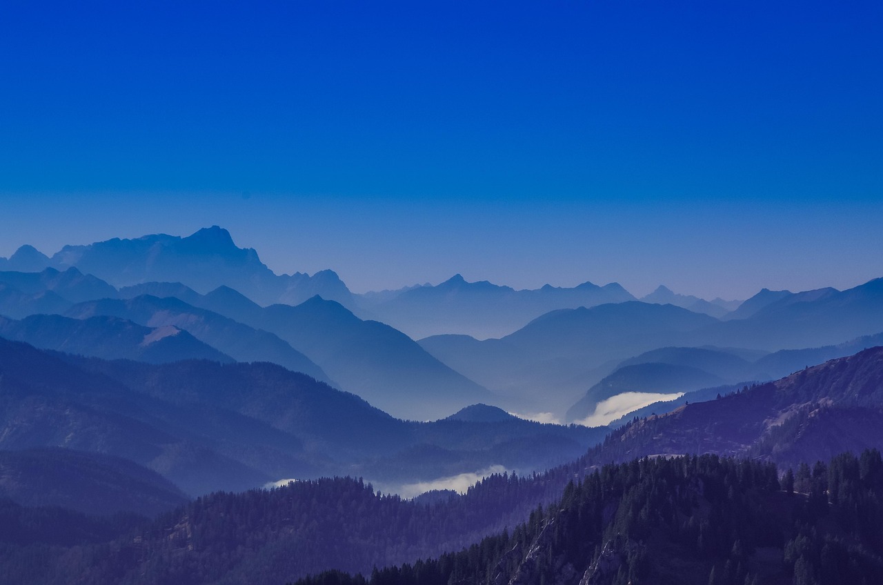
At first glance, the hardscrabble terrain of Big Bend National Park looks like a moonscape: desolate, silent, and slightly threatening. But give it twenty-four hours, and you’ll realize this is arguably the most underrated wilderness in the lower 48. Encompassing over 800,000 acres of the Chihuahuan Desert, Big Bend is a place of dramatic contrasts—where 1,500-foot limestone cliffs plunge into the Rio Grande and "sky island" mountain ranges provide a lush, pine-scented refuge from the desert floor.
I’ve spent years exploring off-the-beaten-path destinations, and Big Bend remains a personal favorite because of its sheer isolation. However, that isolation requires meticulous planning. The park saw a record-breaking 581,000 visitors in 2021, and that popularity hasn't slowed down. If you want to experience the magic without the headache, you need to understand the rhythm of this landscape. The absolute best time to visit Big Bend is from November through April. During these months, daytime temperatures hover in the comfortable 60s and 70s°F, a far cry from the lethal 100°F+ heat that dominates from May through September.
Essential Logistics: Getting to the Far West Texas Border
Getting here is half the adventure—and I’m not being poetic. Big Bend is remote. Most visitors choose to fly into Midland International Air & Space Port (MAF), which is about 200 miles (3 hours) from the park entrance. If you’re coming from El Paso, expect a 300-mile drive, and from San Antonio, it’s a solid 400-mile haul across the vast Texas interior.
When I make this drive, I always follow one golden rule: Never pass a gas station. You should top off your tank in Marathon (if coming from the east) or Study Butte/Terlingua (if coming from the west). Once you’re inside the park, fuel is available at Panther Junction and Rio Grande Village, but prices are higher and supply can occasionally be an issue during peak surges.

Marcus’s Pro-Tip: Download your maps for offline use before you leave Alpine or Marathon. Cell service in the park is virtually non-existent once you leave the visitor center hubs, and you do not want to be guessing which gravel road leads to your trailhead when the sun starts to dip.
Top Hiking Trails: Mountain Hikes vs. River Canyons
The beauty of Big Bend is its ecological diversity. You can be standing in a cactus-filled desert in the morning and hiking through a ponderosa pine forest by noon. I categorize the hiking here into three distinct zones: the River, the Mountains, and the Desert.
The River: Santa Elena Canyon
If you only have time for one hike, make it the Santa Elena Canyon Trail. This 1.7-mile round-trip trek is low effort for a massive reward. You’ll cross Terlingua Creek (check water levels first!) and ascend a short series of switchbacks before descending into the mouth of the canyon. The limestone walls rise 1,500 feet straight up on either side of the Rio Grande. It is humbling, quiet, and profoundly beautiful.
The Mountains: Lost Mine Trail
For the best "bang for your buck" in terms of views, head to the Chisos Mountains for the Lost Mine Trail. It’s a 4.8-mile round-trip hike with about 1,100 feet of elevation gain. The trail winds through oak and juniper forests before opening up to sweeping vistas of Casa Grande and the Pine Canyon. I recommend starting this hike by 7:30 AM; the small parking lot at the trailhead is usually full by 8:30 AM.
The Iconic Sunset: The Window Trail
The Window Trail (5.5 miles round-trip) is the quintessential Big Bend experience. The trail descends from the Chisos Basin to a V-shaped notch in the mountain wall that frames the desert below. While many people hike this for sunset, remember that you’ll have to hike back up in the dark. Bring a headlamp and keep an eye out for mountain lions, which are active at dusk.
Camping and Lodging: Securing Your Spot 6 Months Out
If you think you can just roll into Big Bend and find a spot to pitch a tent, think again. The days of "first-come, first-served" are largely over here. Camping inside Big Bend is available at three developed sites, and reservations are highly recommended at least six months in advance via Recreation.gov.
| Campground | Elevation | Best For | Shade Level |
|---|---|---|---|
| Chisos Basin | 5,400 ft | Central access to mountain trails | Moderate (Oak/Juniper) |
| Rio Grande Village | 1,850 ft | RVs, winter warmth, near hot springs | High (Cottonwoods) |
| Cottonwood | 1,900 ft | Peace, quiet, and birdwatching | High (Cottonwoods) |
For those looking for a bit more comfort, the Chisos Mountains Lodge is the only non-camping option inside the park. It’s basic, but the location is unbeatable. If everything is booked, look into local outfitters like Far Flung Outdoor Center in Terlingua for off-site glamping and river tours.
CRITICAL UPDATE: The 2026 Chisos Basin Construction Project
If you are planning a trip for the latter half of 2025 or into 2026, pay close attention. Starting in May 2026, a major infrastructure and construction project is scheduled for the Chisos Basin. This project is expected to last approximately two years.
What does this mean for you? Access to the park’s primary mountain hub—including the Chisos Mountains Lodge, the Basin Campground, and several major trailheads (like Lost Mine and the Window)—will be significantly restricted or entirely closed. If Big Bend is on your bucket list, I strongly urge you to visit before May 2026 to ensure you have access to the heart of the mountains.
Suggested Itineraries: From 24 Hours to a Full Week
Depending on how much time you have, your Big Bend experience will vary wildly. Here is how I’d break it down:
- The 1-Day Highlight: Drive the Ross Maxwell Scenic Drive. Stop at Homer Wilson Ranch, hike Santa Elena Canyon, and catch the sunset at the Window View (the paved 0.3-mile path near the lodge).
- The 3-Day Explorer: Spend Day 1 on the River (Santa Elena + Tuff Canyon). Spend Day 2 in the Mountains (Lost Mine Trail + the Hot Springs). Spend Day 3 exploring the desert floor and the Fossil Discovery Exhibit.
- The 7-Day Adventurer: This is where you get into the backcountry. I recommend the Outer Mountain Loop for experienced backpackers or exploring the remote Ernst Tinaja and Mariscal Mine via a high-clearance 4WD vehicle.
Beyond the Park: Terlingua Ghost Town & Marfa Art Scenes
You can't come all the way to Far West Texas and ignore the culture. Just outside the western entrance is Terlingua Ghost Town. It’s a quirky, rugged community of artists, desert rats, and miners' ruins. Grab dinner at the Starlight Theatre—the food is surprisingly high-end, and the "porch culture" is legendary. You haven't truly "done" Big Bend until you’ve sat on the porch at sunset with a cold drink, listening to local musicians.
If you have an extra day, drive 90 minutes north to Marfa. It’s the polar opposite of Terlingua: minimalist, high-concept art galleries and chic boutiques. Check out the Marfa Lights viewing area or take the mandatory photo at Prada Marfa (actually located in Valentine, TX).
FAQ
Is there cell service in Big Bend? Hardly any. You might get a bar or two at Panther Junction or near the Chisos Mountains Lodge, but for 95% of the park, you’ll be off the grid. Download your maps and logistics ahead of time.
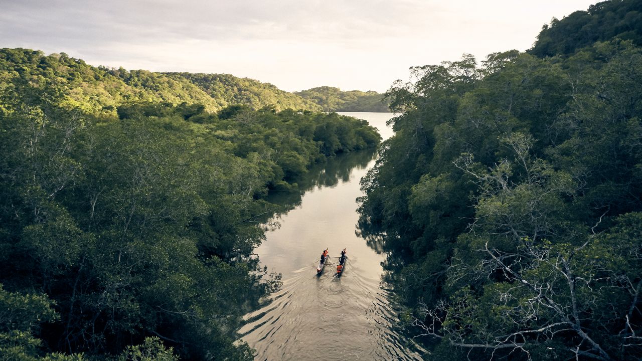
Can I cross the border to Boquillas, Mexico? Yes, but you must have a valid passport. The Boquillas Port of Entry is open Friday through Monday (check seasonal hours). You cross the river via a small rowboat (for a few dollars) and can enjoy lunch in the village. It’s a fantastic cultural addition to any trip.
Are bears and mountain lions a threat? They are present, especially in the Chisos Mountains. Black bears returned to the park naturally in the 1980s and are now common. Store all food in bear-proof lockers (provided at campsites) and never leave a backpack unattended. Attacks are extremely rare, but being "bear aware" is mandatory.
What should I pack for desert weather? Layers are your best friend. I’ve seen it drop from 80°F at noon to 35°F by midnight. Pack moisture-wicking base layers, a high-quality sun hat, and more water than you think you need. The general rule is one gallon per person, per day.
Ready for the Wild?
Big Bend isn't just a park; it's a rite of passage for anyone who loves the American West. It demands respect, preparation, and a willingness to embrace the silence. Whether you're standing on the edge of the South Rim or soaking in the historic hot springs at the edge of the Rio Grande, this place changes you.
Start planning your 2025 trip now—before the Chisos Basin goes quiet for its 2026 renovation. Trust me, the stars are brighter out here.